Humantay Lake Hike: Altitude, Difficulty, and Trail Guide
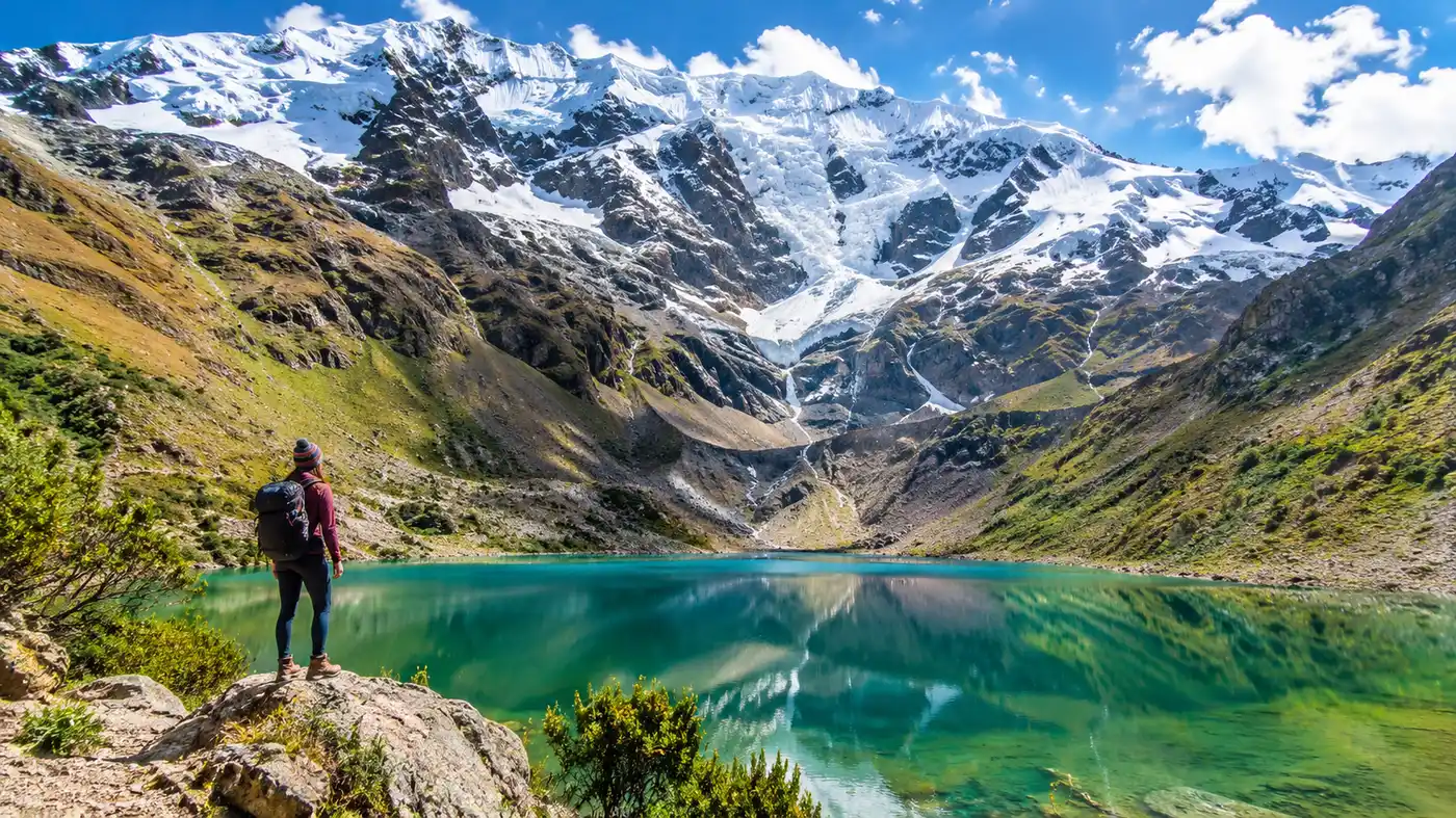
My alarm went off at 3:15 AM in Cusco, and thirty minutes later I was bouncing in the back of a damp Sprinter van wondering if climbing up to a turquoise puddle at 13,779 feet was actually a sane life choice. Most travelers wonder about the humantay lake hike difficulty before committing to that bone-jarring morning drive, and for good reason. It looks deceptively simple on social media, just a smiling backpacker standing in front of neon-blue glacial meltwater, but the trail demands serious respect from your lungs and your knees.
The hike itself covers a surprisingly short distance, yet nearly everyone who steps off the dirt flat at Soraypampa ends up bent double over their trekking poles within twenty minutes. If you want a straight answer on how rough it gets, how to survive the punishing altitude, and how to pace yourself on the loose rock, this guide will lay out the reality so you do not suffer unnecessarily on the mountain.
Book your humantay lake experience:
Understanding the Humantay Lake Hike Difficulty
The raw numbers fool people. The total Humantay Lake hike length is only about 4.3 miles round trip, starting from the Soraypampa campsite and tracing up the ridge to the shore. That sounds like a casual weekend stroll through local hills. It is not. You start hiking at roughly 12,700 feet above sea level and climb straight up a mountain wall. There are almost no flat sections once you cross the small wooden bridge over the riverbed. The gradient kicks up immediately and stays between 20 and 40 percent the entire way up.
How long is the hike to Humantay Lake under normal conditions? Most fit walkers reach the water in about an hour and twenty minutes, while anyone struggling with the thinner air will take closer to two and a half hours. The descent takes another 45 to 60 minutes, and coming down is often where people slip. The dirt is dry, powdery, and mixed with marble-sized shale that acts like ball bearings under hiking boots.
Horses are available at the trailhead for travelers who find the slope overwhelming. Local horsemen charge about 80 to 100 soles for a one-way ride up the mountain. Keep in mind that the horses cannot carry you across the final rocky ridge, so you still have to walk the steepest last 200 meters on your own two feet.
Note: Horse rentals only go up, not down. Walking down on the loose gravel is unavoidable, so bring sturdy shoes with genuine tread even if you plan to hire a mule.
Humantay Lake Elevation and Altitude Realities
Let us talk about the actual numbers because people throw them around casually without feeling what they mean. The trailhead at Soraypampa sits at 3,890 meters, which is around 12,762 feet. The lake itself rests at 4,200 meters, or roughly 13,779 feet. That means the Humantay Lake elevation gain is just over 1,000 vertical feet packed into a distance of roughly 1.3 miles of pure uphill slog. When you ask how high is Humantay Lake compared to Cusco, remember that Cusco sits around 11,150 feet. You are stepping off the bus already higher than the city, then walking into air that holds roughly 40 percent less oxygen than sea level.
That jump in altitude hits your blood hard. Every ten steps, your calves burn and your pulse hammers in your ears. It is very common to feel a mild, dull headache blooming behind your temples halfway up the trail. If you land in Cusco on a Tuesday and attempt the Humantay Lake trek on Wednesday, you are setting yourself up for pure misery. You need at least two full days resting and walking around the cobblestones of the Sacred Valley or Cusco before tackling this grade.
| Trail Checkpoint | Elevation (Meters / Feet) | Distance from Start | Typical Time |
|---|---|---|---|
| Mollepata (Breakfast Stop) | 2,900 m / 9,514 ft | Drive waypoint | 2 hours from Cusco |
| Soraypampa Trailhead | 3,890 m / 12,762 ft | 0.0 km / 0.0 mi | Start point |
| Mid-Ridge Rest Area | 4,050 m / 13,287 ft | 1.2 km / 0.75 mi | 45 - 60 minutes |
| Humantay Lake Shore | 4,200 m / 13,779 ft | 2.2 km / 1.36 mi | 75 - 120 minutes |
| Glacial Viewpoint (Optional Rim) | 4,260 m / 13,976 ft | 2.7 km / 1.67 mi | 90 - 140 minutes |
A lot of hikers compare this trail to other high-altitude routes in the Andes. If you are debating between mountain excursions, reading a breakdown of Rainbow Mountain vs Humantay Lake can help you decide which altitude profile fits your physical readiness, because Rainbow Mountain climbs even higher, reaching over 16,500 feet, but features a significantly flatter path.
Step-by-Step on the Humantay Lake Trail
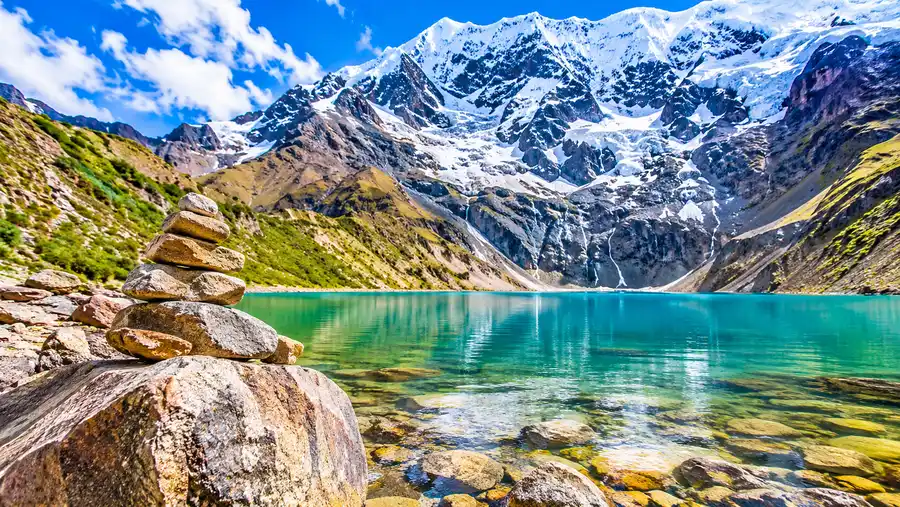
The morning begins in the freezing chill of Soraypampa. You step out of the van, zip your fleece tight, and look straight up at the twin giants of Mount Salkantay and Mount Humantay. The first ten minutes across the valley floor offer a cruel illusion. The ground is flat, grassy, and soft underfoot. You pass domed glamping tents and muddy donkey corrals, feeling energized and chatting with other travelers.
Then the slope starts. The Humantay Lake trail splits into two main paths about fifteen minutes in: the horse trail on the left and the pedestrian footpath on the right. Both are steep, but the foot trail is slightly less chewed up by hooves. The dirt here is fine and silty. When three dozen hikers are climbing in front of you, they kick up a constant cloud of dust that coats your throat, so pulling a buff over your nose helps tremendously.
Pro tip: Take tiny, rhythmic steps rather than long strides. Keep your pace slow enough that you can breathe purely through your nose without gasping for air every twenty seconds.
About halfway up, the trail braids into several steep shortcuts created by tourists trying to scramble ahead. Stick to the wider switchbacks. The shortcuts are slick with scree and waste far more energy than they save. You will pass a collection of makeshift wooden benches where local Quechua women sell bottles of water, Gatorade, and candy bars for about 5 to 10 soles. Stop there for five minutes. Catch your breath, swallow some water, and look down at the valley shrinking beneath you.
The final push is the hardest mental test. You will reach a rocky crest where you expect to see the water, only to realize there is one more steep shelf of boulders. Clamber over that last rise, turn slightly to the right, and the turquoise water suddenly appears right against the base of the glacier. The silence hits you first. The wind whips across the surface, and the sheer scale of the hanging ice above the water makes the hour of lung-busting labor feel completely justified.
Book your humantay lake experience:
Packing, Pacing, and Beating the Humantay Lake Hike Difficulty
Preparation is the difference between enjoying the summit and sitting on a rock feeling nauseous. The cold morning temperatures will trick you into wearing heavy parkas that you will desperately want to peel off within ten minutes of ascending. Layering is non-negotiable here. A thermal base layer, a light fleece, and an outer windbreaker will keep you comfortable as your body temperature spikes during the climb.
Here is what you actually need in your daypack to handle the route comfortably:
- Trekking poles: completely essential for saving your knees on the loose gravel during the descent.
- At least 1.5 liters of water: dehydration accelerates altitude sickness faster than any physical exertion.
- High-sugar snacks: chocolate bars, dried fruit, or nuts to provide quick energy when your appetite drops.
- Coca candies or leaves: an ancient local remedy that genuinely helps open up constricted airways.
- Polarized sunglasses: the high-altitude sun reflecting off white glacial ice will strain your eyes instantly.
If you are exploring regional routes, you might notice that Humantay serves as the very first acclimatization side-trip on longer adventures. Many hikers take on this exact path as part of the broader Salkantay Trek to Humantay Lake and Machu Picchu before continuing onward toward the high pass the following morning. If that is your plan, treat the lake hike as an easy warm-up and resist the urge to sprint to the top.
Weather plays a massive role in trail safety. During the dry season from May to October, the path is dry and dusty. From November through April, afternoon rain turns the steep silt into thick, slick mud that makes footing precarious. If you want to dive deeper into season patterns before booking your tour, check out our guide on Humantay Lake weather and the best time to visit to pick the clearest months.
Humantay Lake History, Sacred Lore, and Cold Realities
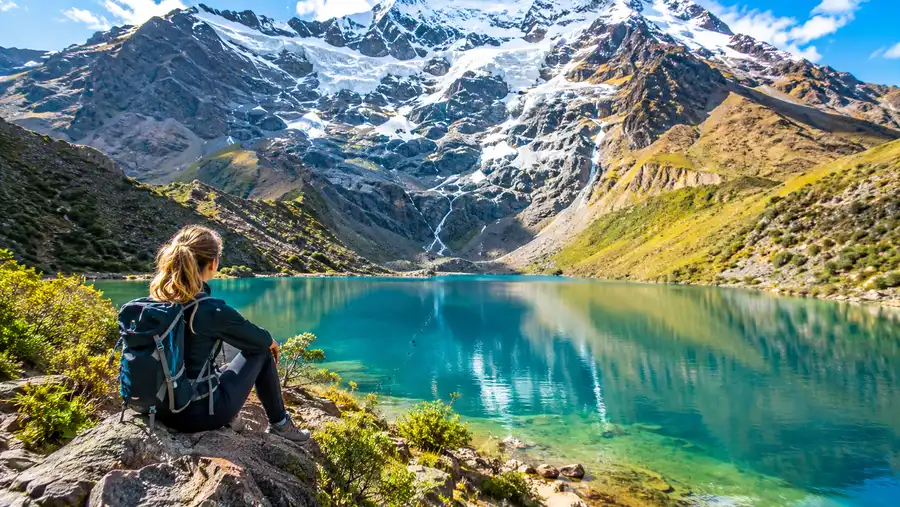
Humantay is not just a scenic photo opportunity. To the Quechua-speaking communities of the Anta province, this body of water is an Apu, a sacred mountain deity that protects the valleys below and feeds irrigation channels during the dry winter. For centuries, spiritual pilgrimages were made to the glacier edges to leave offerings of coca leaves, colorful textiles, and carved stones known as apachetas. When you stand near the water, you will see small towers of balanced stones built along the shoreline. While tourists often mimic them for photos, the locals construct them as respectful prayers to the mountain spirits for safe passage.
Many travelers arrive with dreams of polar plunges. So, can you swim in Humantay Lake? Absolutely not. Swimming in the lake is strictly forbidden by local authorities and park rangers who watch the perimeter. First, the water is a primary drinking and agricultural supply for downstream villages in the Soraypampa and Mollepata valleys, meaning sunscreen and body oils contaminate local water systems. Second, the water temperature hovers between 2 and 5 degrees Celsius (35 to 41 degrees Fahrenheit). Jumping into freezing water at an altitude of nearly 14,000 feet triggers immediate cold-water shock and severe hypothermia within minutes, miles away from hospital care.
Take your photos from the shoreline or hike the extra ten minutes along the left-hand ridge to get a panoramic view from above. That ridge trail gives you a much better vantage point of Mount Salkantay towering in the distance, and it stays far less crowded than the main beach area where tour groups gather.
Frequently Asked Questions about humantay lake hike difficulty
How hard is the hike for someone who doesn't work out regularly?
It is definitely challenging if you are not accustomed to steep climbs. The short distance makes it achievable, but you must take it very slowly, rest every few minutes, and use hiking poles to ease the strain on your legs.
Can you get altitude sickness at Humantay Lake?
Yes, altitude sickness is very common here because the lake sits at 13,779 feet. Symptoms include headaches, dizziness, nausea, and shortness of breath. Spend at least 48 hours acclimatizing in Cusco before attempting the hike.
Are there bathrooms along the Humantay Lake trail?
There are basic, rustic bathrooms at the Soraypampa base camp and one small outhouse halfway up near the horse resting area. You will need to pay 1 or 2 soles to use them, and you must bring your own toilet paper.
Quick Reference
- Trailhead: Soraypampa (3,890 m / 12,762 ft)
- Lake summit: 4,200 m / 13,779 ft
- Round-trip distance: 4.3 miles (7 km)
- Average hike time: 2 to 3.5 hours total
- Horse rental cost: 80 - 100 PEN (uphill only)
Book your humantay lake experience:
The Bottom Line
The climb up to Humantay Lake is short, steep, and will test your lungs in ways you probably did not anticipate during breakfast in Cusco. It is not an easy walk, but it is entirely manageable if you respect the altitude, take tiny steps, and keep your ego out of your pace. Give yourself a couple of quiet days in town to adjust to the thin Andean air, rent a set of trekking poles from an outdoor shop near the Plaza de Armas, and start climbing slowly. The sight of that turquoise glacial bowl tucked beneath towering granite peaks will wipe away every ounce of exhaustion the second you crest the ridge.
Read more about humantay lake.